Showing posts with label los altos. Show all posts

Thursday, September 26, 2013

Trail racing in the Bay Area for October 2013

Trail racing in the bay area is at its best in  October in my opinion. The heat of summer is mostly behind us replaced by the crisp, cool autumn weather. A little rain starts to creep in and the dry dusty hardpack gives way to a softer more forgiving trail. The colors are changing and the trees are really begging to be looked at. If your not out in the woods in October you may want to check your status as a trail runner. Check out the upcoming races around the bay and do yourself a solid, sign up for an awesome race.

Sunday, January 13, 2013

Ranch San Antonio route planner

Rancho San Antonio Open Space Preserve
I thought this was so cool I just had to share it. Stevens Creek Software has a web page called Rancho Runner. On this page is a map of the Rancho San Antonio Open Space Preserve. All of the trailheads and intersections have been given either a letter or a number and what you are supposed to do on this page is write down your route. As an example, if you start at trail head E and run to intersection K, then on to intersection 3, over to intersection B and back to intersection 3 and back to trailhead E that would be written EK3B3E in the space provided on the web page and then you click the Show Distance button and each segment of your route is listed along with the segments distance and elevation gain or lose. At the bottom of the route segments list is the total distance and total elevation gain . To make it easier I have written down the "route" for the popular PG&E trail out & back; 1b2v454v2b1. You will see this route proves to be 8.52 miles long with a gain of 2155 feet.


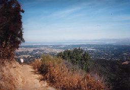
Looking out over California
from Black Mountain Trail
Rancho is a beautiful park to run in and it satisfies both beginners and the more advanced. If you enter the park from any number of trail heads throughout the Los Altos neighborhoods just west of highway 280 and stay in this initial low land on the multiple trails running the length of this park you can avoid some really tough climbs. If you want a good mix of hills try the PG&E trail. If you want to fry your quads climbing all day start at the bottom and go all the way to the top on Black Mountain Trail. At the top you can fall into the Mone Bello Open Space Preserve and keep the adventure rolling.

Take a trip to Rancho San Antonio and plot it out before hand on the Rancho Runner webpage. It's a fun way to get familiar with an often overlooked trail system.

See you in the woods,
Jonathan

Thursday, October 25, 2012

Featured Trail Route: Los Altos Hills 24.5 miles

Mid-Peninsula Open Space Preserve Running
http://www.dailymile.com/routes/1324782-running-route
24.5 mile Los Altos Hills Route

This route takes you through several parks in the Palo Alto and Los Altos area. The run starts at the Pearson-Arastradero Preserve on Arastradero Rd near Page Mill Rd and Highway 280.